
39.92584° N, 125.96075° E
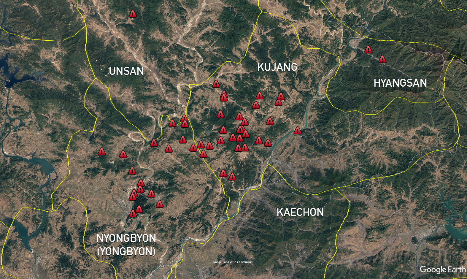
Satellite imagery shows mudslides and swollen rivers throughout DPRK’s northwest.
Google Maps links to mudslides area
https://maps.app.goo.gl/eobGGDEzFSiH2Emt6
https://maps.app.goo.gl/C6wzJLBEMcwYfiWd8
Heavy rains and mudslides damaged newly built homes, roads and cropfields in northwest North Korea last week, including at the sprawling Yongbyon nuclear complex, according to NK Pro analysis of satellite imagery.
Planet Labs imagery shows widespread evidence of mudslides and swollen rivers and streams, primarily in Kujang and Nyongbyon counties of North Phyongan Province, following seasonal monsoon rains between July 21 and 22.
Planet.com seems to be an excellent tool for tracking day to day changes. The satellite imagery is updated almost daily.
State media has covered some major floods in recent years, though usually after more large-scale destruction than last week.